


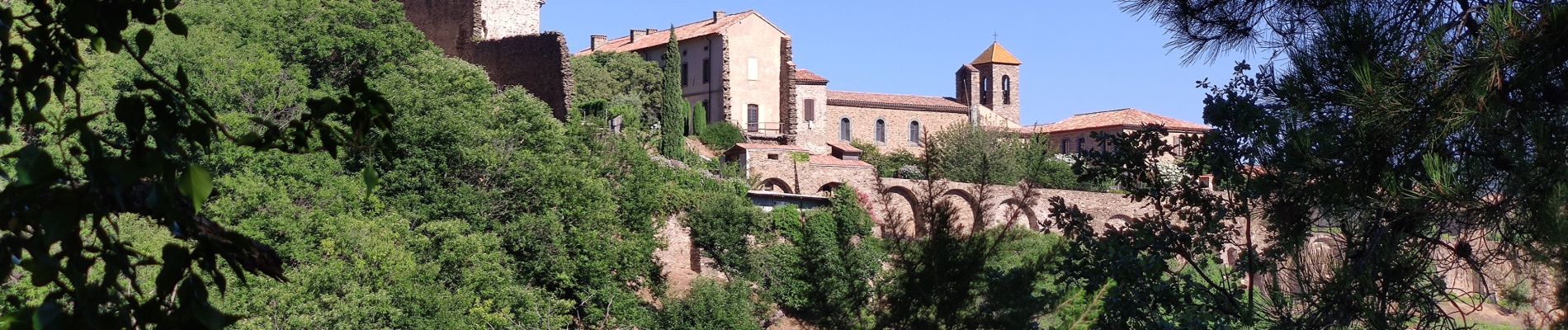
VTT - La Mole - Barrage de La Verne - Chartreuse de La Verne - Capelude - Retour La Mole par les crêtes

affinetataille
User GUIDE
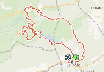

Length
34 km

Max alt
430 m

Uphill gradient
869 m
Km-Effort
45 km

Min alt
26 m

Downhill gradient
870 m
Boucle
Yes
Creation date :
2020-07-20 05:35:55.34
Updated on :
2024-08-14 17:48:50.345
4h41
Difficulty : Difficult

FREE GPS app for hiking
 SityTrail
IGN / Geographical institutes
SityTrail Plus
The world is yours!
About
Trail Mountain bike of 34 km to be discovered at Provence-Alpes-Côte d'Azur, Var, La Môle. This trail is proposed by affinetataille.
Description
Remarque : la redescente du monastère se fait par un single assez difficile très pierreux .Si mal à l'aise dans ce type de terrain redescendre par la même piste que la montée.
Photos


Positioning
Country:
France
Region :
Provence-Alpes-Côte d'Azur
Department/Province :
Var
Municipality :
La Môle
Location:
Unknown
Start:(Dec)
Start:(UTM)
293978 ; 4787096 (32T) N.
Comments